

Computer vision
Detection, segmentation and tracking on aerial, camera and lab images.
High-precision computer vision, big farm data collection, mass EUDR calculations and KPI dashboard automation at low cost for those who need it most.

Open them in your browser, no installation, no sign-up wall.

API AGRI reads a set of geospatial layers for any coordinate — rainfall, temperature, elevation, water stress, soil class, growing degree days, dry spell risk, soil pH, organic carbon, C/N ratio, texture, root depth, water table depth and aquifer type — and turns them into a plain-language read of the plot, with an explainer behind every figure.
A three-stage AI pipeline then reasons over the same data — first as an academic researcher, then a corporate agronomist weighing ESG and cost, then a farmer giving practical, plain-spoken advice — grounded in a retrieval system built on real field and lab records, not generic guidance. Available in 10 languages.
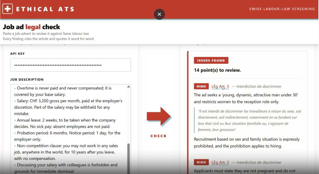
Launch API AGRIEthical ATS is an applicant tracking system built for HR teams who want to hire fairly. Write your job ad, and an AI legal check compares it with Swiss labour law to flag wording that could discriminate by age, gender, origin or family situation, with a suggested rewrite for each point.
Candidates then apply through a simple form, and their CVs arrive in one place. A public API lets other platforms submit a job description and receive the same legal check.
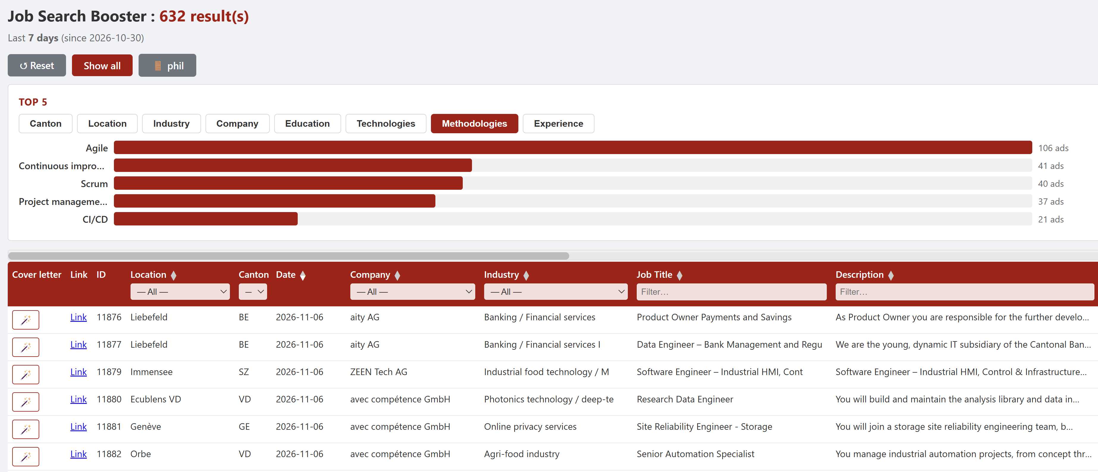
Visit Ethical ATSJob Search Booster turns the unstructured ads published on Job Room, the Swiss public employment platform, into a proactive database. Every ad is translated into English, classified by canton, industry, company and technology, and every word of its description is indexed.
Job seekers can filter hundreds of new data jobs a week in seconds, see the top cantons, industries and skills at a glance, and draft a cover letter for any ad.
Search jobsField data collection, deforestation checks and carbon footprint for agrifood companies and NGOs.

Vertical integration of plot data with external indicators like water stress and carbon sequetrability to generate accurate, boardroom-ready ESG reports for agrifood companies.

Upstream traceability is not a luxury—it is legal compliance. We automate calculations by analyzing plot coordinates against historical satellite imagery (Dec 2020) and real-time updates.
We propose decision tools, using the GHG baseline and asking AI for recommendations.


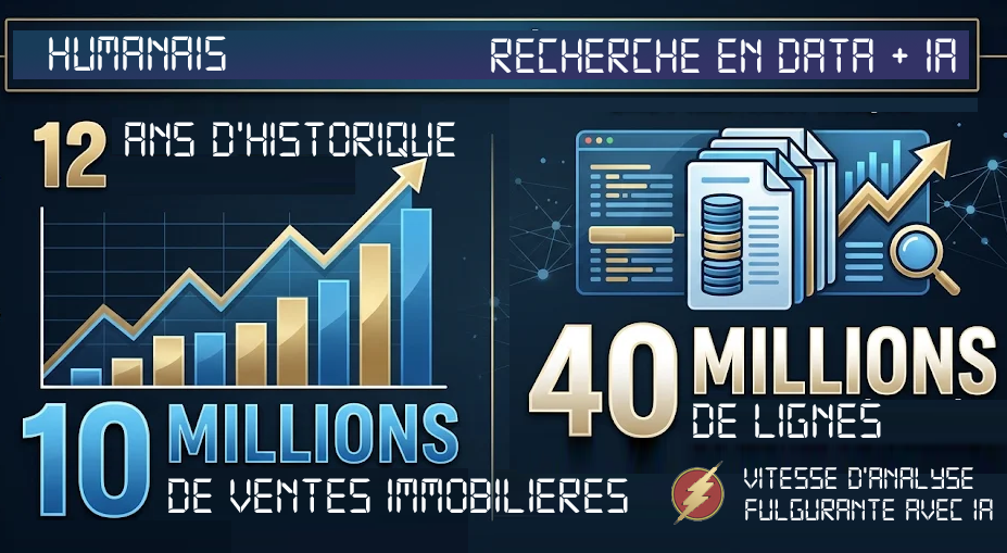
Humanais bridges the gap between frontier AI labs and humanitarian organizations. We ensure global challenges are met with the best tools available, regardless of funding size.
Aerial imagery, plates, blueprints and documents turned into structured data.
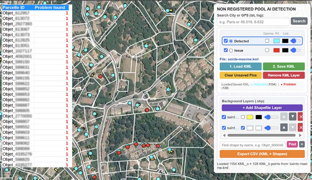
Municipalities need accurate property and tax data. Our AI automatically detects undeclared pools, extensions, and outbuildings by cross-referencing high-resolution aerial photos with official land registries.
Recover tax discrepancies and update municipal cadasters in real time with high-precision computer vision.
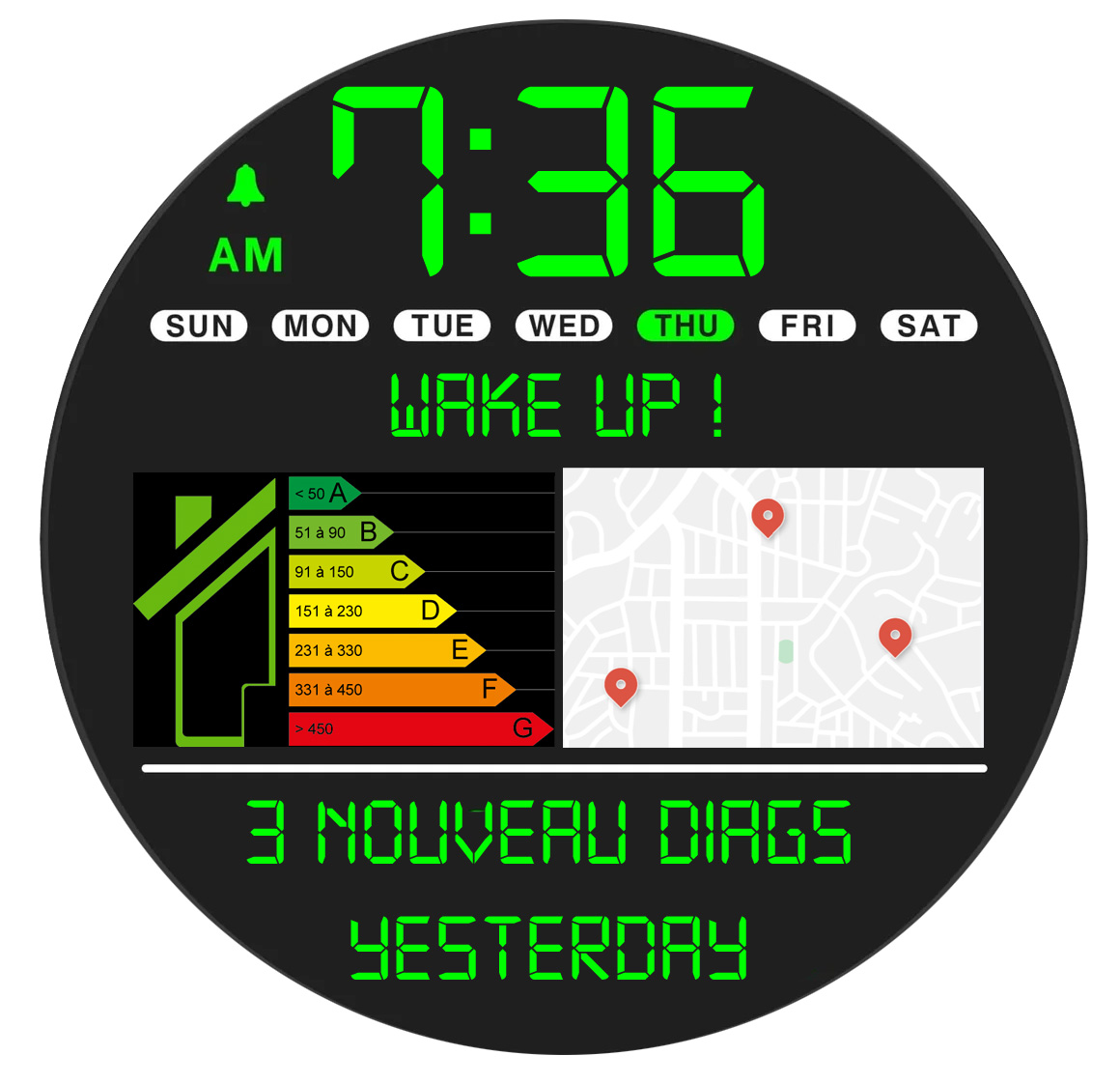
In France, a home cannot be sold or rented without an energy performance certificate (DPE), so a new DPE is often the first sign that a property is about to come on the market. DiagRadar watches the ADEME open data and flags the new certificates in the town you follow: a daily email, a day-by-day summary, a map and filters.
An information tool built on public data: no owner contact details, no intermediation, no commission.
Open DiagRadarWhat did the houses in your street really sell for? Every property sale recorded in France (DVF open data) is grouped street by street: date, price, price per m², floor and land area, type of property.
Each street is cross-checked with the energy performance certificates (DPE) of the same addresses, so price, size and energy class can be read side by side before buying, selling or estimating.
Open A quel prix ?Hundreds of listings? Swipe left to skip, swipe right to keep: Peekolo shows every property in a flash, even in large numbers.
Your right-swipes are kept in a shortlist to review calmly, and you can contact the real estate agent of any single property in one tap. Multilingual, on iOS and Android.
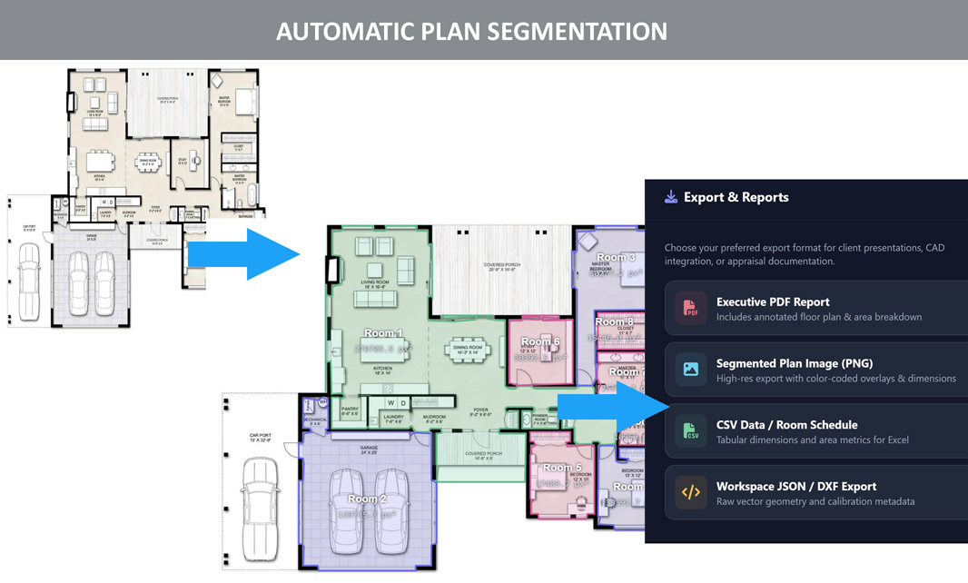
Open PeekoloSave time with automatic segmentation, area calculations, report generation.
Open the tool
We can also turn heteregoneous lab analysis reports into structure databases
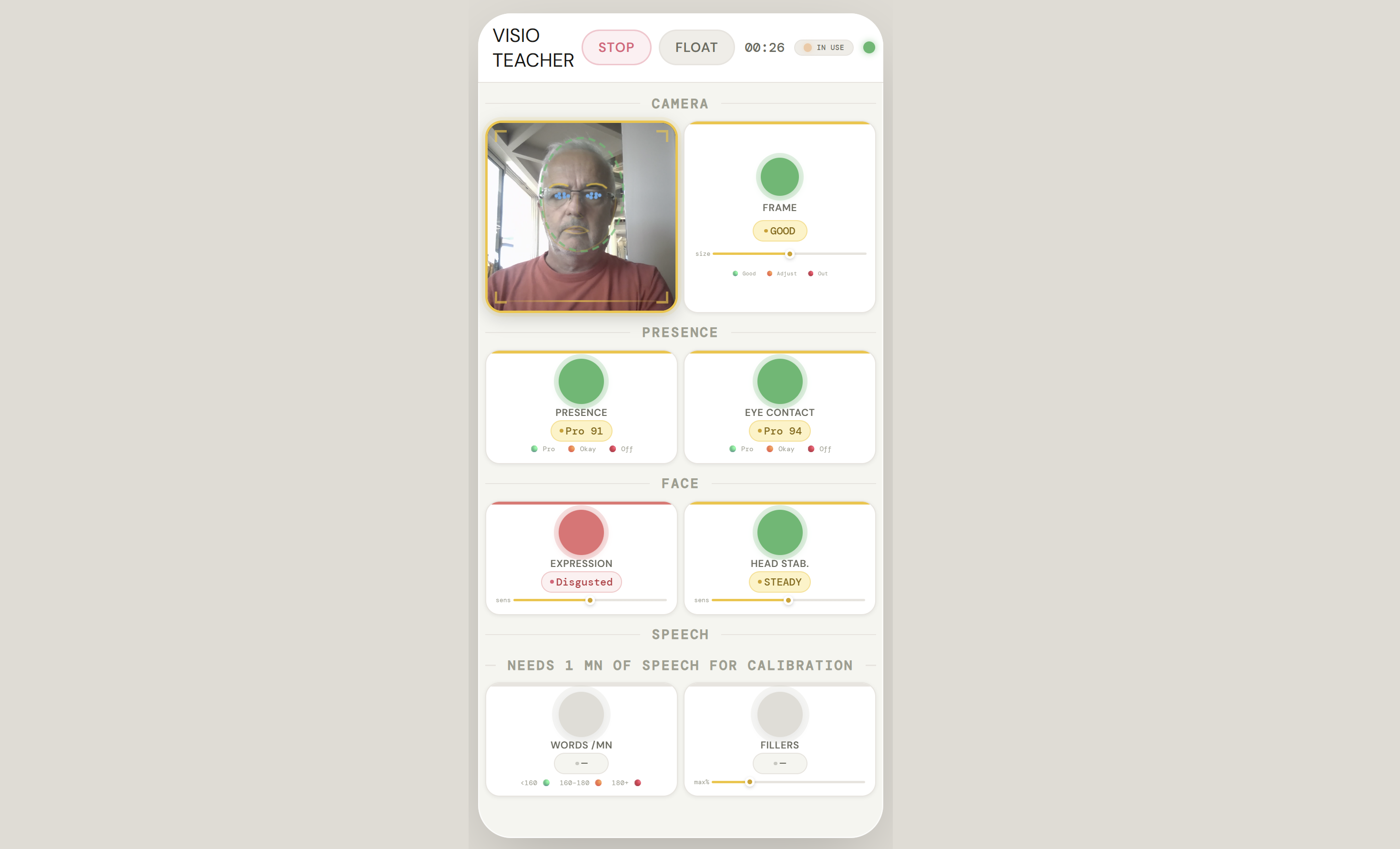
Our Visio-teacher.com analyzes your session while you are talking and advices you in real-time to smile more, move less the head around, articulate, less eye-blinkin, etc...
Try Visio TeacherInteractive maps, simulations and games for teams, students and makers.
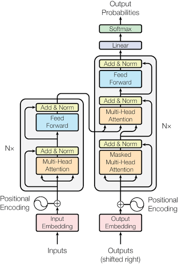
Attention Is All You Need is a foundational paper in natural language processing. Our simulator helps researchers and educators explain the inner workings of transformer architecture.
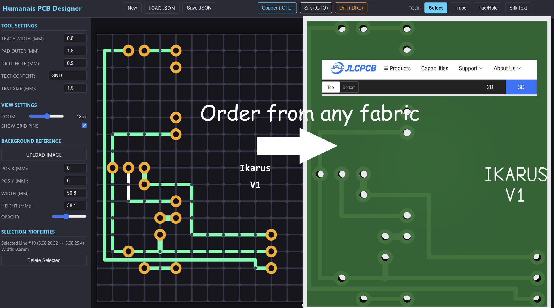
Our web-based PCB design tool empowers researchers, educators, and makers to lay out custom circuit boards directly in the browser. Easily fine-tune trace widths, pad dimensions, drill holes, and layer silkscreens in real time.
Generate production-ready Gerber files (Copper GTL, Silk GTO, Drill DRL) instantly to order custom boards from any fabrication house—driving low-cost hardware innovation for field sensors and educational programs worldwide.
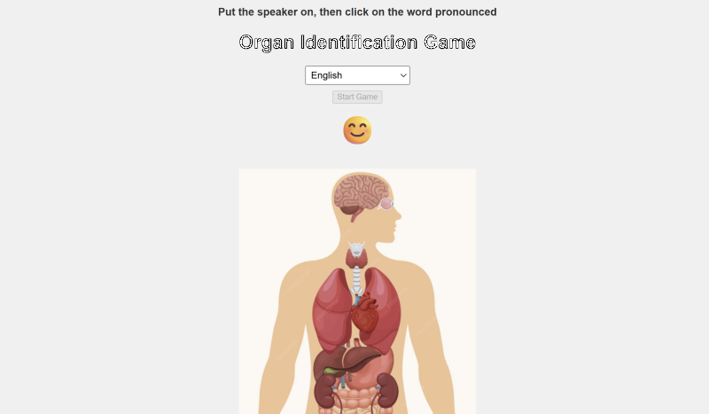
Open the toolOur interactive anatomy game introduces children to human body organs through engaging visuals and multi-language support. Designed to make early science education fun, accessible, and intuitive.
Children can explore and identify vital organs across different linguistic settings, fostering early bilingual development while building fundamental biological awareness.
Open the toolSkanoo helps children learn through simple activities, with a voice that reads the content aloud and guides them step by step.
Children who cannot see the screen well can follow the same lessons as their classmates, at school or at home.
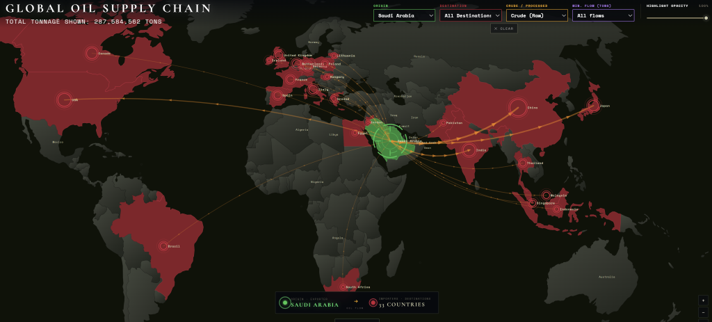
Open SkanooInteractive world maps fed by your own data, to show markets, supply risks and opportunities at a glance.
We connect our maps to CSV or Excel files and generate dynamic reports.
Open the toolPicoGIS is an ultra-light GIS for people who need to look at geographic data, not to learn a full desktop GIS. Open your layers, switch them on and off, and read the map in seconds.
Ideal for field teams, NGOs and managers who only need the essentials, on any computer, with no installation and no licence.
Open PicoGISEach project on this site combines these building blocks. Click a project to see it in the visual portfolio.
Detection, segmentation and tracking on aerial, camera and lab images.
Aerial imagery, cadastre and GIS, from a single field to a world map.
AI agents grounded in your own documents, rules and laws.
From raw field data to APIs and board-ready dashboards.
Interactive tools that make AI and science accessible to everyone.

Certified Business Analyst with past experience working for global cap headquarters such as Cargill, Reuters, and Nestlé.
Master Data Engineer and AI specialist bridging advanced computer vision, geospatial architecture, and humanitarian technology solutions.

Author of video games with over 100 million downloads, with extensive industry experience in game design and development.
Engineer and coder specializing in code efficiency, with a core focus on gameplay.
Qualified non-profit inquiries typically receive a response within 5 business days.